ACAP Latest News

Read about recent developments and findings in procellariiform science and conservation relevant to the Agreement on the Conservation of Albatrosses and Petrels in ACAP Latest News.

Contact the ACAP Communications Advisor if you wish to have your news featured.

Tracking pelagic birds at sea: limitations to accuracy of light-level geolocators investigated with Calonectris shearwaters

Scopolis Searwater John Borg
Scopoli's Shearwater Calonectris diomedea at sea, photograph by John Borg

Luke Halpin (School of Biological Sciences, Monash University, Clayton, Australia) and colleagues have published in the journal Methods in Ecology and Evolution on testing the accuracy of light-level geolocators on three species of Calonectris shearwaters.

The paper’s abstract follows:

  1. Light-level geolocators are popular bio-logging tools, with advantageous sizes, longevity and affordability. Biologists tracking seabirds often presume geolocator spatial accuracies between 186 and 202 km from previously innovative, yet taxonomically, spatially and computationally limited, studies. Using recently developed methods, we investigated whether assumed uncertainty norms held across a larger-scale, multispecies study.
  2. We field-tested geolocator spatial accuracy by synchronously deploying these with GPS loggers on scores of seabirds across five species and 11 Mediterranean Sea, east Atlantic and south Pacific breeding colonies. We first interpolated geolocations using the geolocation package FLightR without prior knowledge of GPS tracked routes. We likewise applied another package, probGLS, additionally testing whether sea-surface temperatures could improve route accuracy.
  3. Geolocator spatial accuracy was lower than the ~200 km often assumed. probGLS produced the best accuracy (mean ± SD= 304 ± 413 km, n= 185 deployments) with 84.5% of GPS-derived latitudes and 88.8% of longitudes falling within resulting uncertainty estimates. FLightR produced lower spatial accuracy (408 ± 473 km, n = 171 deployments) with 38.6% of GPS-derived latitudes and 23.7% of longitudes within package-specific uncertainty estimates. Expected inter-twilight period (from GPS position and date) was the strongest predictor of accuracy, with increasingly equatorial solar profiles (i.e. closer temporally to equinoxes and/or spatially to the Equator) inducing more error. Individuals, species and geolocator model also significantly affected accuracy, while the impact of distance travelled between successive twilights depended on the geolocation package.
  4. Geolocation accuracy is not uniform among seabird species and can be considerably lower than assumed. Individual idiosyncrasies and spatiotemporal dynamics (i.e. shallower inter-twilight shifts by date and latitude) mean that practitioners should exercise greater caution in interpreting geolocator data and avoid universal uncertainty estimates. We provide a function capable of estimating relative accuracy of positions based on geolocator-observed inter-twilight period.”

Reference:

With thanks to Ken Morgan.

Halpin, L.R., Ross, J.D., Ramos, R., Mott, R., Carlile, N., Golding, N., Reyes-González, J.M., Militão, T., De Felipe, F., Zajková, Z., Cruz-Flores, N., Saldanha, S., Morera-Pujol, V., Navarro-Herrero, L., Zango, L., González-Solís, J. & Clarke, R.H. 2021.  Double-tagging scores of seabirds reveals that light-level geolocator accuracy is limited by species idiosyncrasies and equatorial solar profiles.   Methods in Ecology and Evolution doi.org/10.1111/2041-210X.13698.

John Coo per, ACAP Information Officer, 06 September 2021

An introduction to using Earth observation data from satellites to study albatrosses - and other seabirds

Wandering Albatrosses Michelle Risi Ellyn Bousman Lentz
"Sing a Song" - paper collage for ACAP by Ellyn Bousman Lentz, after a photograph of Wandering Albatrosses by Michelle Risi

Lonneke Goddijn-Murphy (Environmental Research Institute, University of the Highlands and Islands, Thurso, United Kingdom) and colleagues have published in the journal Remote Sensing Applications: Society and Environment on the value of utilizing `Earth Observation data via satellites for studies of seabird and their habitats, at breeding colonies and at sea.

The paper’s abstract follows:

“Remote sensing, the science of obtaining information about objects or areas from a distance, has the potential to contribute greatly to conservation, ecology and biodiversity studies. Here, we introduce remote sensing capabilities that could contribute to seabird studies, covering remoting sensing of seabirds directly, and indirectly through remote sensing of seabird habitats. We focus on satellite remote sensing, as these data are the most readily available, and are mostly freely available, and we also present some additional Earth observation (EO) data. This is not an exhaustive list, rather a selection of practical and user-friendly data and tools that are publicly available. At present, the spatial resolution of optical commercial satellite imagery is high enough to identify the largest seabirds such as penguins and albatrosses. Military satellites are capable of higher resolutions that can detect 10 cm objects, but these are not available to the general public. Satellite observation and other EO datasets containing geographic and sea surface condition variables are useful for complementing seabird sightings and tracking data, with their associations justifiable for certain species, breeding status and locations. This paper is aimed at researchers in the fields of seabird conservation, ecology, and biodiversity whose research would benefit from satellite data and from knowing what data sources are available.”

See also a report on a publication in ACAP Latest News on counting albatrosses from space.

With thanks to Alex Bond.

Reference:

Goddijn-Murphy, L., O’Hanlon, N.J., James, N.J.,  Masden, E.A. & Bond, A.L. 2021.  Earth observation data for seabirds and their habitats: An introduction.  Remote Sensing Applications: Society and Environment 24. doi.org/10.1016/j.rsase.2021.100619.

John Cooper, ACAP Information Officer, 03 September 2021

79 000 active Buller’s Shearwater burrows counted on New Zealand’s Poor Knights Islands

Bullers Shearwater off Mercury Islands MZ Kirk Zufelt
Buller's Shearwater off Mercury Islands, New Zealand; photograph by Kirk Zufelt

 Megan Friesen (Northern New Zealand Seabird Trust, Auckland, New Zealand) and colleagues have published in the journal Emu – Austral Ornithology on a breeding census of the globally Vulnerable and nationally Naturally Uncommon Buller’s Shearwaters Ardenna bulleri.

The paper’s abstract follows:

“Accurate and repeatable population estimates are key to establishing population trends and conservation status. Rako, or Buller’s Shearwater (Ardenna bulleri) is a seabird endemic to New Zealand that breeds only on the Poor Knights Islands, but forages throughout wider areas of the Pacific Ocean during the non-breeding season. The lack of threats on the breeding grounds and the wide foraging range of Buller’s Shearwaters makes them ideal sentinels of ocean health. Although they are commonly seen at sea and the population in the 1980s was thought to be around 2.5 million birds, other rapid land-based surveys suggested a much lower figure (~100,000 pairs on Aorangi), and no thorough population estimate has been undertaken to date. We calculated a population estimate for Buller’s Shearwater based on burrow counts and state of occupancy conducted at the Poor Knights during either the 2016–2017 or the 2017–2018 breeding seasons. We incorporated information on habitat availability and preference in population models. Our estimate of 78,645 (95% confidence interval 67,176–89,178) active burrows, broadly representing breeding pairs, is lower than some previously published assessments. This is a repeatable quantitative study of the Buller’s Shearwater breeding population, including breeding activity, and provides critical baseline data to determine population trends for this potentially important marine indicator species.”

Reference:

Friesen, M.R., Simpkins, C.E., Ross, J., Anderson, S.H., Ismzar-Rebitz, S.M.H., Tennyson, A.J.D., Taylor,G.A., Baird, K.A. & Gaskin, C.P. 2021.  New population estimate for an abundant marine indicator species, Rako or Buller’s Shearwater (Ardenna bulleri).  Emu – Austral Ornithologydoi.org/10.1080/01584197.2021.1924066.

John Cooper, ACAP Information Officer, 02 September 2021

Featuring ACAP-listed species and their photographers: the Grey Petrel by Jeremy Bird

 
An incubating Grey Petrel in its burrow on Macquarie.  Burrows were visited throughout the season to estimate population size and breeding success, photograph by Jeremy Bird

NOTE: This is the third in an occasional series that aims to feature photographs of the 31 ACAP-listed species, along with information from their photographers.  Here, Jeremy ‘Jez’ Bird writes about the ACAP-listed and globally Near-Threatened Grey Petrel Procellaria cinerea, a species he studied for his recently awarded PhD.

 8 burrowscopeTheir burrow-nesting habit makes Grey Petrels difficult to survey.  Here Jez uses a dedicated ‘burrowscope’ on Macquarie’s steep slopes

The Southern Ocean islands are out of sight and out of mind for most of us, but they support some amazing wildlife and I’ve been passionate about the region since visiting on a travel scholarship as an 18-year-old.  Twenty years later, still inspired by that first experience, I’ve just completed a PhD studying the recovery of threatened seabirds on Macquarie Island, Australia.  This sub-Antarctic island is currently responding to the removal of invasive predators.  Pest management began with the eradication in 1998 of the Weka Gallirallus australis , a globally Vulnerable species of rail native to New Zealand which was originally introduced as a food source for sealers, followed by feral cats in 2000 and rabbits, rats and mice in 2011.

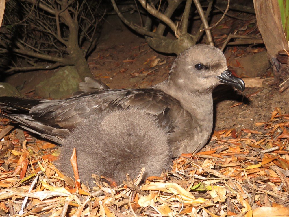
 7 grey petrel chick credit Jez Bird
A Grey Petrel chick starts to lose its down, photograph by Jeremy Bird

Among the birds I studied was the Grey Petrel.  Found on a number of sub-Antarctic islands, the largest recorded population is on Antipodes Island south of New Zealand.  Grey Petrels were reported historically on Macquarie Island, but there was no evidence of breeding after the early 1900s.  In the 1990s, when the cat population was under control and on its way to eradication, Grey Petrels recolonised.  No island-wide surveys of the population had been undertaken since 2003 although the Tasmania Parks and Wildlife Service has continued monitoring at some core breeding sites.  I completed a whole-island survey and found the population has increased to c. 250 breeding pairs today.  Based upon the current population size and trajectory we expect them to warrant removal from Australian state and federal threatened species lists within the next few years.

spypoint03
A camera trap positioned at a burrow entrance records an entering Grey Petrel

Petrels are notoriously difficult to study.  They typically breed on remote islands, often in rugged terrain.  Birds only frequent colonies in certain seasons, and they with few exceptions only visit their nesting burrows at night to avoid native avian predators such as skuas.  They mostly nest in underground burrows whose entrances can be obscured under dense vegetation.  As a result, much of my year was spent searching for and counting burrows, and then trying to figure out what was in them.  I used a dedicated ‘burrowscope’ to help with this and used camera traps to record activity at individual nests.  By following nests through the season I found that almost 80% of nesting attempts were successful – way higher than when invasive species are present, as for example on Macquarie in the past and currently on South Africa’s Marion Island where Grey Petrels remain at risk to House Mice (click here).

We also deployed geolocator tags on a number of birds.  These tags were attached to the legs and retrieved the next season when the birds returned to their breeding burrows.  Using an internal clock, each day the tag logs sunrise and sunset whose timings tell us longitude, whereas day length tells us latitude.  We are now using this information to illustrate potential overlap of Macquarie’s Grey Petrels with fisheries throughout their at-sea range, and to understand better their population structure.  For example, we know the recolonizing Grey Petrels have arrived from Macquarie from elsewhere and the rate at which the island population is growing suggests immigration is still occurring, but we don’t know where the source population is.  As the impact of climate change in the Southern Ocean intensifies understanding how connected species’ populations are and what capacity they have to move help decisions over island management to be made.


1 jb burrow searching credit Toby TraversI spent most of my year on Macquarie Island searching for seabird burrows and trying to figure out what was in them, photograph by Toby Travers

I loved immersing myself in the lives of these birds for a year.  Learning from remote recording devices when they first arrived back at their colonies. Reading how males sit atop tussock heads and ‘hose’ their staccato calls at the night, before waiting after dark to see it for myself.  Watching hatching chicks, still wet and complete with egg tooth, gradually grow and transform into sleek fledglings, seen disappearing for the last time as I flicked through camera trap photos.  Following the annual cycle of Grey Petrels on Macquarie has given me immense enjoyment and respect for the hardships they endure year in year out.

Much of my work reported here can be found in my two recent papers and in my thesis which has just been published online.

References:

Bird, J.P. 2021.  The Conservation Ecology of Burrowing Petrels on Macquarie Island.  PhD Thesis.  Brisbane, Australia: School of Biological Sciences, The University of Queensland.  216 pp. [click here].

Bird, J.P., Fuller, R.A., Pascoe, P.P. & Shaw, J.D.S. 2021.  Trialling camera traps to determine occupancy and breeding in burrowing seabirds.  Remote Sensing in Ecology and Conservation doi.org/10.1002/rse2.235. [click here]

Bird, J.P., Woodworth, B.K., Fuller, R.A. & Shaw, J.D. 2021.  Uncertainty in population estimates: a meta-analysis for petrels.  Ecological Solutions and Evidence doi.org/10.1002/2688-8319.12077.

Jeremy Bird, School of Biological Sciences, The University of Queensland, Brisbane, Australia, 01 September 2021

The ACAP Advisory Committee starts its Twelfth Meeting today, held virtually for the first time

 Light mantled Albatross Andrea Siemt
Preening Light-mantled Albatross, watercolour for ACAP by Andrea Siemt; after a photograph by Oli Prince

 As for nearly all international meetings affected by COVID-19, the Twelfth Meeting of ACAP’s Advisory Committee (AC12) and of two of its working groups are being held virtually; a first for ACAP.  This year’s meetings - delayed from last year by the pandemic - are now being held from 16/17 August to 1/2 September (depending on where one is in the world).  Meetings of the Seabird Bycatch Working Group (SBWG10) and the Population and Conservation Status Working Group (PaCSWG6) preceded AC12, from 16/17 to 18/19 August and 23/24 to 24/25 August, respectively.  These two working groups (and the Taxonomy Working Group) will give their reports to AC12.

AC12 is meeting from 30/31 August to 1/2 September, preceded by a one-hour closed Heads of Delegation Meeting.  The meeting is being chaired by Nathan Walker (Ministry for Primary Industries, New Zealand), with the support of Vice-Chair Tatiana Neves (Projeto Albatroz, Brazil).  The Advisory Committee’s current membership may be viewed by scrolling down from here.

Nineteen Documents (including AC12 Doc 02: Annotated Meeting Agenda and work programmes for the next several years) and nine Information Papers (including 2021 Implementation Reports from six Parties) have been tabled for consideration, leading to an expected busy meeting over the three days allotted.  All these documents can be downloaded from this website.

Further information on the virtual meeting of AC12 is available in AC12 Circular 5 in the three official ACAP languages of English, French and Spanish, giving information on timing at different localities around the world.  Congress Rental has been chosen to manage the technical aspects of the meeting, using the Interprefy platform.  Interprefy enables “relay interpretation” (involving multiple languages – three in the case of ACAP).  Congress Rental has been providing technical advice to Chairs, Secretariat, interpreters and to other participants.

John Cooper, ACAP Information Officer, 31 September 2021

The Agreement on the
Conservation of Albatrosses and Petrels

ACAP is a multilateral agreement which seeks to conserve listed albatrosses, petrels and shearwaters by coordinating international activity to mitigate known threats to their populations.

About ACAP

ACAP Secretariat

119 Macquarie St
Hobart TAS 7000
Australia

Email: secretariat@acap.aq
Tel: +61 3 6165 6674